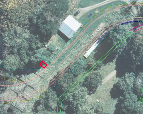
The curved red lines mark the proposed road route. The dark green dashed lines are the outside boundaries of the land owned by City Council.
The small red rectangle between the sheepyards and the shed on the dark green dashed line was thought to be the possible location of the c1841 gravesite. It was later found to be corrugated iron.

This image shows the reading that helped the archaeologists decide where the gravesite might be, but was not.